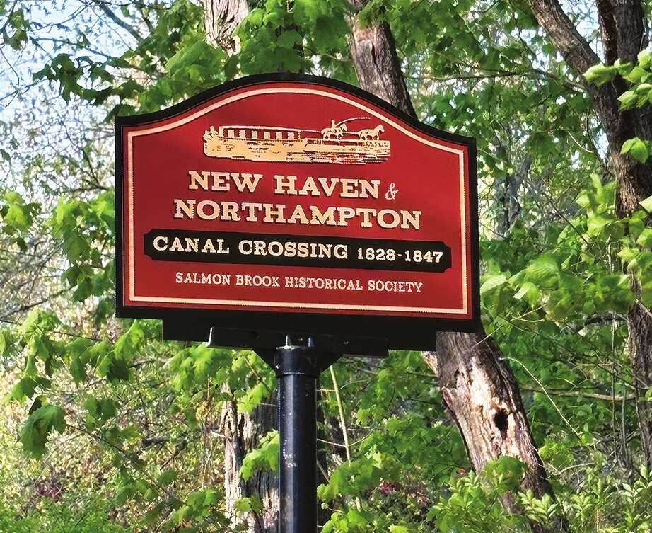
The Salmon Brook Historical Society partnered with the Town of Granby to install two new interpretive signs commemorating historic New Haven and Northampton Canal sites in Granby. The signs will help residents and visitors to rediscover an important chapter of Granby’s early history.
The signs were installed in May between 10 and 12 Petersen Road and 76 and 80 Hungary Road, marking sites where the canal passed through Granby during the mid-19th century.
The project is part of an ongoing effort to preserve and highlight the legacy of the New Haven and Northampton Canal—known locally as the Farmington Canal—that once connected Granby to larger markets and provided transportation in southern New England. These signs help to make forgotten history visible again.
The canal was one of the most ambitious infrastructure projects of its era and briefly placed Granby at the center of regional commerce and innovation. Today, it’s easy to drive through Granby without realizing that a canal once cut directly through town, linking local farmers, merchants, manufacturers and residents to New Haven Harbor and beyond. And, in 1835, when the Hampshire and Hampden Canal Company completed its portion through Southwick’s Great Ponds (Congamond Lake) to join the Connecticut River in Northampton, the canal was 83 miles long.
The canal’s connection to Granby began with an extraordinary ceremony. On Monday, July 4, 1825, the official groundbreaking for the canal project was held in Salmon Brook Village, now known as Granby Center. An estimated 3,000 people attended the celebration, including Canal President James Hillhouse, and Connecticut Governor Oliver Wolcott Jr., who, as he dug into Granby soil, broke the ceremonial gold shovel. The minister of First Church expressed his displeasure that many of the party attendees had started celebrating on July 3, the sabbath.
A festive parade that stretched for two miles marched to the Southwick line and back to the Granby Green where a banquet was served under a “bouerie”. Featured in the parade was a festive canal boat mounted on wheels and pulled by six horses that Capt. George Rowland had driven to the festivities from New Haven.
Construction through Granby proved especially challenging. Hand-dug by shovel, the canal’s highest elevation or “summit level,” required complex engineering, locks, culverts and careful water management. Engineers battled repeated flooding, washouts and drought conditions before the canal became operational.
Despite those obstacles, by 1830 canal boats regularly carried agricultural products, timber and manufactured goods through Granby. The canal briefly transformed the town into an active transportation corridor, enabling local products—including Granby apples and most notably, its famous apple brandy—to reach distant markets more efficiently than ever before.
Ultimately, the rise of railroads, repeated maintenance problems, flooding and farmers’ vandalism led to the canal’s demise in 1848. Though the waterway disappeared from everyday view, traces of it remain hidden throughout many towns in stonework, depressions and historic routes still visible today.
Historical society leaders feel the new signs can connect modern residents to a period when Granby played a surprisingly important role in Connecticut’s transportation and economic history.
“These markers remind us that preserving local history is about more than remembering old structures,” SBHS President Howard Berg explained. “It is about understanding how earlier generations shaped our community and how their vision and hard work connected Granby to the wider world.”
The society hopes the project will encourage public interest in the canal’s history and promote historical tourism and education.
For more information about the canal visit the New Haven and Northampton Canal Greenway website at nhncanal.org and the Connecticut Writers’ Project, Boats Across New England Hills at https://docs.farmingtoncanal.info/WPA_Farmington_Canal_1941.pdf