In this time of the pandemic, the Salmon Brook Historical Society has found a way to stay outdoors while sharing Granby’s history. Stroll Through Granby History is an opportunity to both walk and learn while being appropriately distanced from each other because it is all done outside.
Granby’s central historic district includes about 35 homes or buildings with known stories. From Oct. 2 to 29, the society invites people to stroll from the Salmon Brook Historical Society properties at 208 Salmon Brook Street north to the green and learn about town history as told by 32 of the houses.
In recognition of the 75th anniversary of the historical society, the society will place a temporary sign with a picture of the original house in each front yard. In addition to the picture, the posters will include a QR code. Walkers can learn about the history of the house and the people who lived in them by using the QR code on their smartphone or tablet.
What do you need before you begin? You need to go to the App Store on your phone or tablet and install a QR Code Reader. This is a no-cost app that will allow you to read the QR code on each sign. The QR code will then access the information about each house located on the Salmon Brook Historical Society website.
Maps will also be available to be printed from the SBHS website —salmonbrookhistoricalsociety.com—and the house’s information and story will be available on the web page going forward.
None of this would have been possible without Carol Laun’s deep knowledge, Howard Berg’s efforts digitizing pictures, Ed Judge, Jay Harder and Madeline Catania of the Granby Camera Club, and web designer, Janice Gucciardi, from Jabberhead.
The society members are pretty excited about this project to get the information from inside the SBHS archives out into the community.
Stroll through Granby History – 2020
Starting west side, south end of Salmon Brook St., walking north
207 – Chapman house
211 – Delia Church house
213 – Crocker house
221 – Smith-Cooley house
225 – Dr. Pendleton’s Hospital
227 – The Parsonage
229 – Jewett-Gillin house
231 – Jewett-Hotchkiss house
233 – Jewett-Smith-Cooley house
235 – Jewett-Maltbie house
239 – Bunce house
245 – James Lee Loomis house
251 – Colton house
255 – Gaines Hotel
259 – Loomis Store #1
261 – James Newton Loomis house
East side of Salmon Brook St.,
by the Town Green, walking south
4 East Granby Rd – Case house
2 Park Place – Granby Hotel & Avery house
On Town Green – Civil War Monument
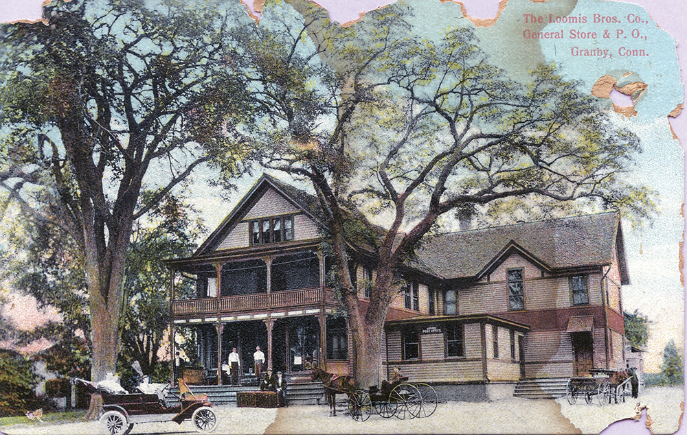
258 – Loomis Bros. Store #3
256 – Loomis Bros. Store #2 & Print Shop
254 – Holcomb-Shattuck house
252 – Asel Rice house
250 – Rev. T. Murphy house
248 – Library building and South Church
238 – Dennison Case house
234 – Samuel Benjamin’s church
230 – Cooley-Goddard house
226 – George Pettibone house
Salmon Brook Historical Society
208 – Weed-Enders house
208 – Abijah Rowe house
208 – Cooley School
This map is also available on the historical society’s website: salmonbrookhistoricalsociety.com